Kaiser Warm Spring hike near Burro Creek
People walking the hiking trail of the Kaiser Warm Spring
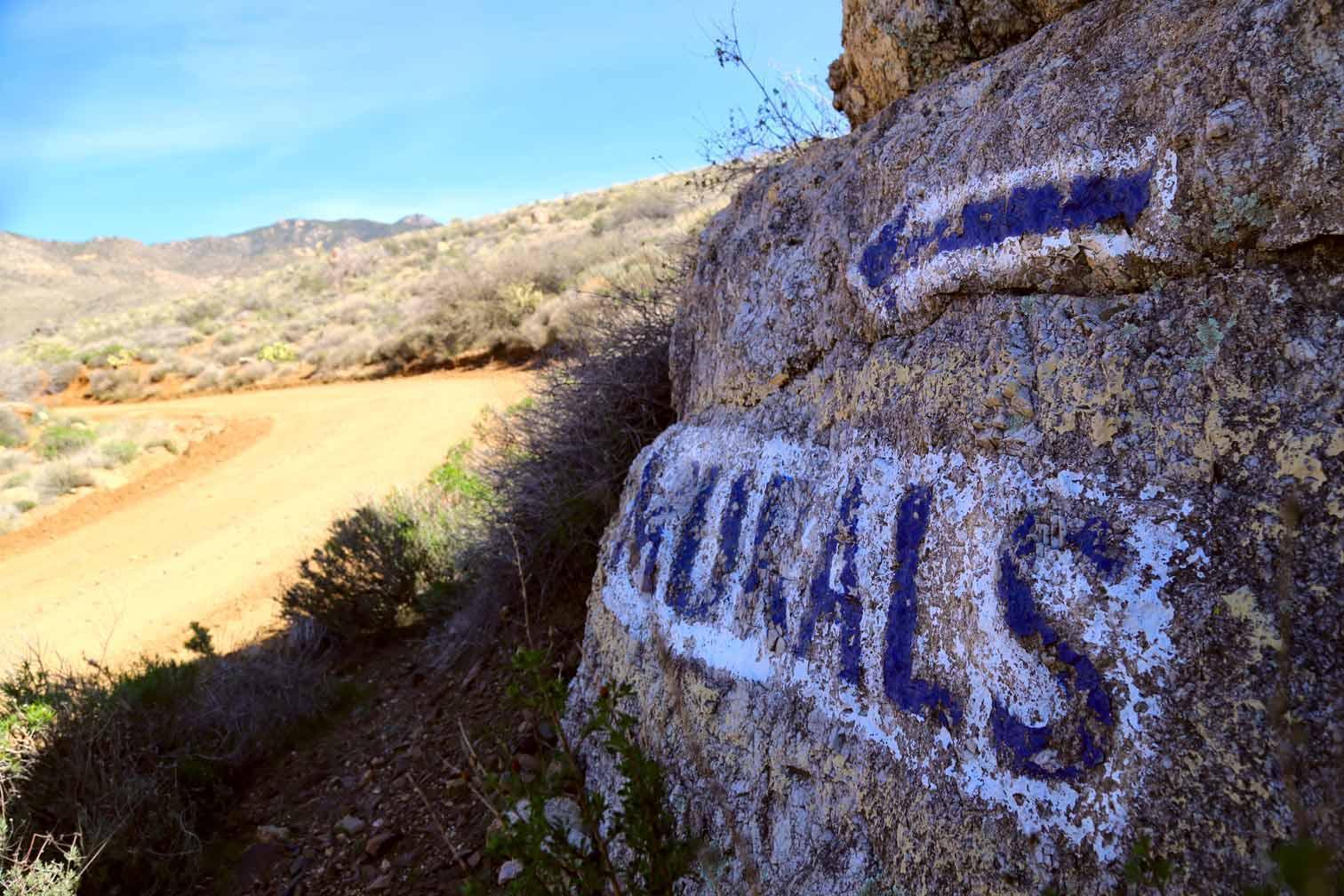
![Chloride AZ Murals rock sign]()
Chloride Murals rock sign
A Chloride Murals rock sign with an arrow
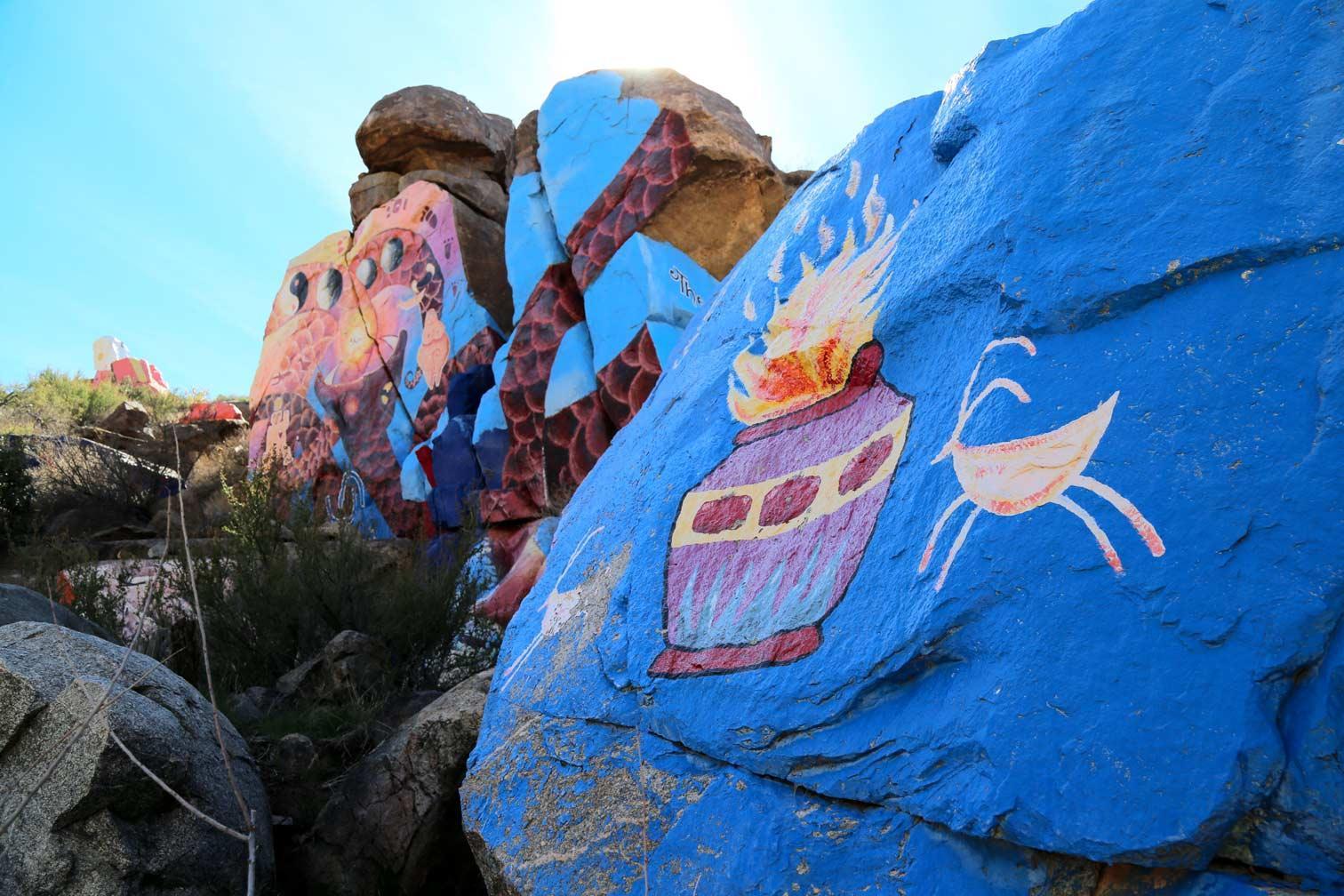
![Image content]()
Chloride Murals
Amazingly painted paintings on the Chloride Murals
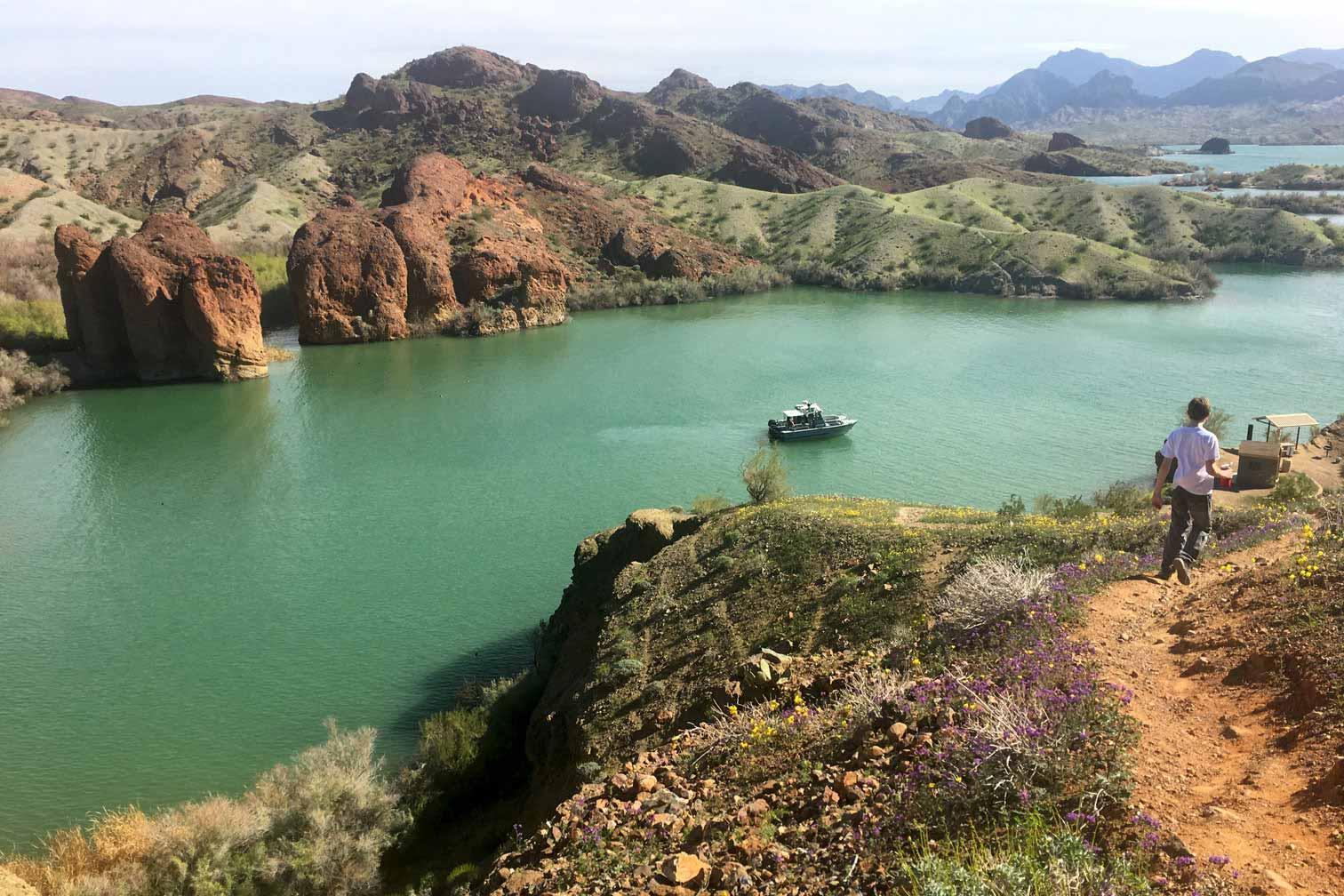
![End of Crack in the Mountain Trail, Sarah Park in Lake Havasu]()
Crack in the Mountain Trail end
Gorgeous view of the lake in the Crack in the Mountain Trail
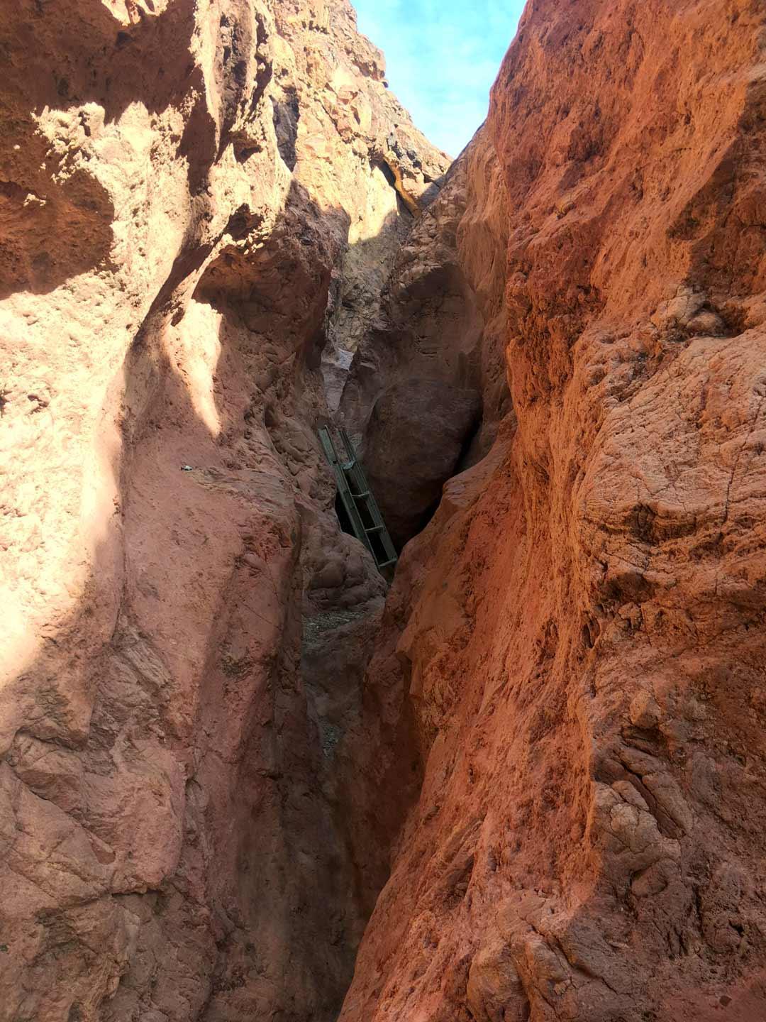
![Crack in the Mountain Trail, Sarah Park in Lake Havasu]()
Crack in the Mountain Trail, SARA Park LHC
Big crack in the mountain with a ladder in it
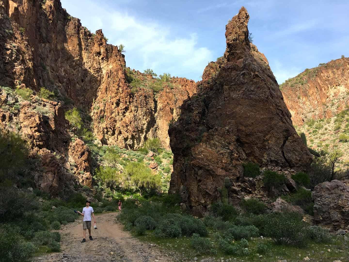
![Crack in the Mountain Trail, Sarah Park in Lake Havasu]()
Crack in the Mountain Trail
Amazing view if the Crack in the Mountain Trail
Previous
Next
Kingman is surrounded by unique land formations, marks of historic migration, and vegetation of both the Mojave and Sonora deserts. Venture the trailways, and you’re bound to find something of note, something that rejuvenates and inspires. Though many such sites are off in the craggily mountainscapes, there are a select few easy to get to spots that are well worth the visit. We’ve selected five to highlight here.
To make the list of easy and interesting, a trail needed to satisfy the following:
It should have some interesting feature that you won’t see on too many other trails.
It should require no more than 1.5 miles one way with little climbing or elevation change to reach the interesting feature.
It should be easy to get to, with parking at or close to the trailhead,
It should to be within 66 miles of Kingman (more specifically from the Powerhouse, home of the Kingman Visitor Center where travelers go for area travel information).
As a quick reminder, anytime while venturing outdoors in the Southwest, take precautions; watch for rattle snakes March through October and take water, especially during the warmer temperatures from May through September.
1. Monolith Gardens Trail is a hidden gem. The name is derived from many slender, towering boulders, which is why this trail makes this list. Hiking or cycling this trail is good any time of year, but the trail is especially scenic in the spring when flowers are in bloom. The trail is part of the Cerbat Foothills Recreation Area trail system which has 41.4 miles in total, much of which has been added on in the last three years.

Interesting Feature: monolith rock formations
Distance from Kingman: 1.5 miles to Metwell Drive Trailhead, 8 miles to Coyote Pass trailhead
Distance from parking to Trailhead: about 300 hundred feet
Trail Length: ¾ of a mile to see most of the formation, but the total trail length is 9.4 miles.
How to get there: trail is accessible from two trailheads, the best of which (Coyote Pass TH) is accessible along Hwy 93 while heading south into Kingman about ½ mile before the Interstate 40 interchange. Metwell TH, is accessible from Metwell Drive off of Beale Street (Hwy 93) 0.6 miles north of the Interstate 40 interchange.
Best time to go: The trail can be hiked year-round with proper precautions, but Spring is best for mild temps with blooming flowers
Link for more information: gokingman. com/Monolith_Garden
2. Chloride Murals & Petroglyphs is up an old mining road extending from Tennessee Ave (the main road into town from Hwy 93). Most of the time, with a little clearance (no low-riders), you can drive right up to the site. But if the narrow dirt road is rough, it may be better accessed with a short hike. One can park somewhere along the road beyond the cattle guard at the edge of town, which is 1.4 miles from the Murals.

Interesting Feature: Murals painted by artists Roy Purcell in 1966 and prehistoric petroglyphs
Distance from Kingman: 24 miles
Distance from parking to Trailhead: parking is available right at the Murals, if the road is passable
Trail Length: If you must park and walk, you can usually park within ¾ mile to 1 mile of the site.
How to get there: Take Hwy 93 north toward Las Vegas. After MP 53, about 21 miles, the Chloride turn off (Mohave County Hwy 125) will be on the right. This becomes Tennessee Road and leads directly to the Murals.
Best time to go: October through May, the site can be visited year-round with proper precautions
Link for more info: gokingman. com/day-trip-Chloride
3. Crack in the Mountain Trail is accessible from SARA Park in Lake Havasu City, and is a 65 mile drive from the Powerhouse in Kingman. The trail leads one and a third miles mostly down a wash to and to the crack. However, there are some great trails swooping along the base of the mountain. Crack in the Mountain is just that, a 150 yard crack in the mountain or - in nicer terms - a slot-canyon. You can turn around there, but the trail continues another mile to Lake Havasu for the more adventurous.

Interesting Feature: slot canyon
Distance from Kingman: 65 miles from Kingman
Distance from parking to Trailhead: less than 100 feet
Trail Length: 1.4 miles one way to the crack, 2.4 miles if hiking all the way to Lake Havasu
How to get there: Head south on Interstate 40, in 39 miles turn south onto AZ Hwy 95. Continue 26 miles, through Lake Havasu to McCulloch Blvd South, which is roughly 6 miles south of London Bridge (London Bridge is located on McCulloch Blvd North). Turn left on McCulloch Bvld South, the trailhead will be on your left in less than a mile.
Best time to go: February through early April when flowers are in bloom and temperatures are in the 70’s & 80’s, but the temperature should be fair October through April
Link for more info: golakehavasu. com/activities/hiking/trails/grid_detail. aspx? id=7
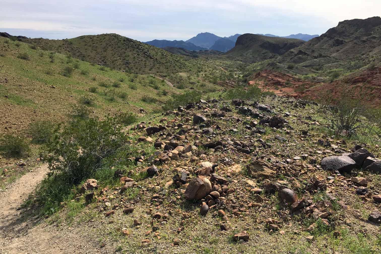
4. Kaiser Warm Spring in the Burro Creek BLM Rec Area is 66 miles from the Powerhouse. There is no trailhead, but you can park within a fifth a mile of the wash that leads to the spring, making it a one and a half mile hike in total – depending on where you park. It’s a relatively easy go. We did much of this with a toddler in a stroller - the kind with three 12” bicycle type wheels, not four little casters. There is a short, 50 foot decent into the wash where I had to fold and climb the thing down the mountain – separately from the toddler, but once in the wash, it was semi-smooth rolling until about the last 500 feet or so. Even if you’re not going for a soak in the warm spring waters, the canyon is worth the hike simply for the fantastic views.

Interesting Feature: warm spring and rock hounding for obsidian
Distance from Kingman: 66 miles
Distance from parking to Trailhead: There is no trailhead, you can park along the dirt road within 0.2 miles of the wash that leads to the spring.
Trail Length: 1.4 to 1.5 miles, depending on where you park.
How to get there: Head east on Interstate 40, in 19 miles take the Hwy 93 turn-off heading South. Continue to the cross-over about ¾ miles past MP 134. Cross-over the highway and continue along the access path heading under the bridge. Park as close to the bridge as you can, even under it if the road is good enough.
Best time to go: October through May, the site can be visited year-round with proper precautions
Link for more info: hikearizona. com/decoder. php? ZTN=1002
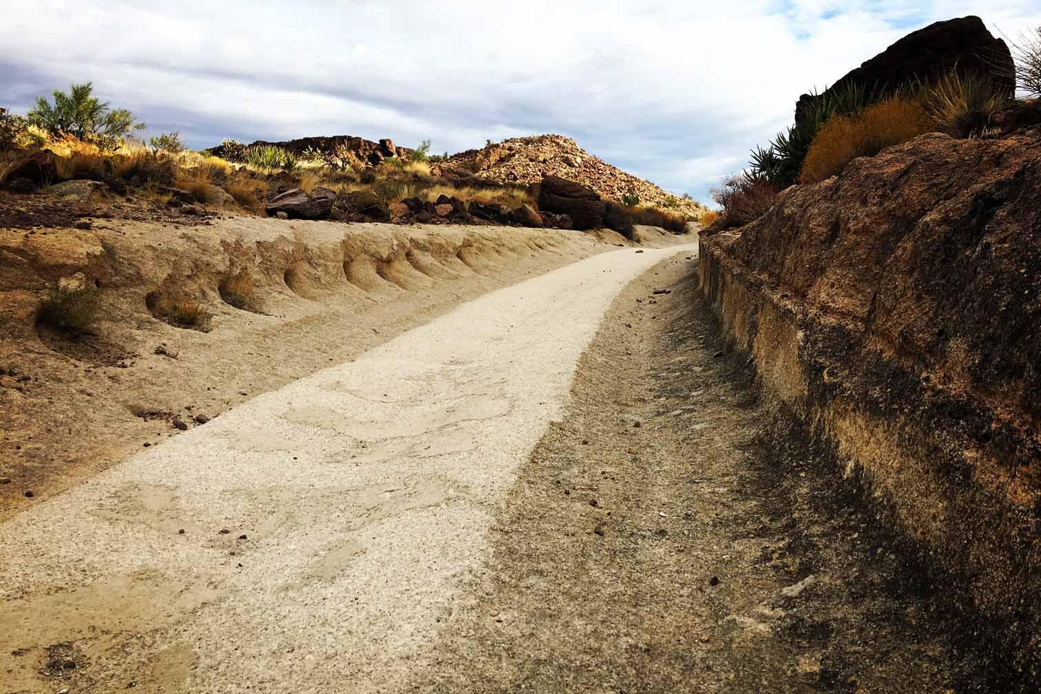
5. While Cliffs Wagon Trail is just one mile from central Downtown Kingman and is part of an old wagon route used in the late 1800s to bring ore up from the mines. There are few places like it in the American west.

Interesting Feature: 125 yr old wagon racks have been cut deep into the stone
Distance from Kingman: 1 mile
Distance from parking to Trailhead: Parking is at the trailhead.
Trail Length: you reach the end of the tracks after 650 feet, although you can continue hiking back along existing trails.
How to get there: Turn onto Grandview Ave from the Hwy 93 / Andy Devine intersection. Continue on Grandview to Lead Street, turn right on Lead Street which turns into White Cliffs Rd. The trailhead will be on the right.
Best time to go: The site can be visited year-round with proper precautions
Link for more info: gokingman. com/attraction-White-Cliffs-Wagon-Trail
 H: 98°